Drying Catchment

Drying Catchment

Evidence suggests that the climate of the Avon River Basin is changing. Long-term rainfall records show wide-spread declines in rainfall since the 1970s. Climate models predict drier winters, warmer temperatures, and more frequent and intense droughts and summer rains. The variability currently being experienced along with predicted changes must potentially change the way we farm and manage resources in the catchment.

How can we monitor progress?

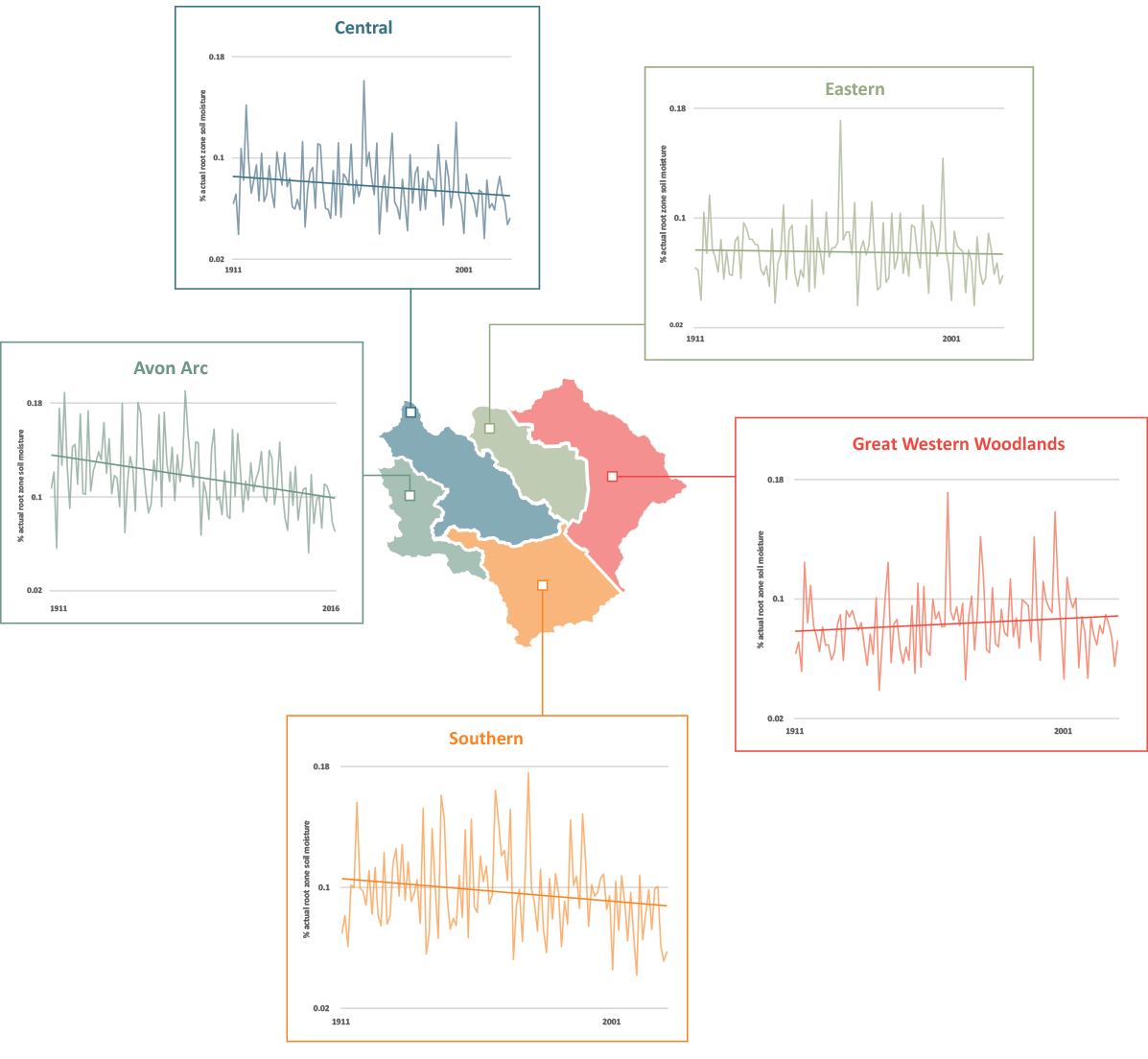
Wheatbelt NRM uses the following data to help monitor the amount of water in the Avon River Basin catchment: regional catchment run-off, root-zone soil moisture, fire occurence, bushfire potential, river levels and rainfall.

Root-zone soil moisture

The average percentage of actual annual root zone soil moisture across sub-regions of the Avon River Basin between 1911-2020. The relationship is significant at 95% for the Avon Arc only.

Source: Bureau of Meteorology Australian Landscape Water Balance

Disclaimers: The values represent average percentage soil moisture across large areas, therefore the range of soil moisture values within each region is large. See the map to further explore patterns in soil moisture across your area of interest.

River levels and rainfall, soil moisture and fire occurrence and bushfire potential

Click here to view the map in fullscreen

The map shows data in three parts; river levels and rainfall; soil moisture and; fire occurrence and bushfire potential. Click through each numbered title to see spatial data on each topic.


Data Sources: Bureau of Meteorology, Geoscience Australia, Bushfire and Natural Hazards CRC

Links

Stay Connected

Subscribe to our updates

Keep up to date on current events, funding opportunities and NRM in the Wheatbelt.

Left Column
Right Column